Downsman’s ramblings I
As a Yorkshireman who’s worked his way south over the years I find myself now as at home on the South Downs as I still am in the Yorkshire Dales. Before lockdown on 16 March I took this picture on Seven Sisters during a 4 hour walk along - up and down! - the cliffs from Seaford to Eastbourne where I feel the chalk is brighter than the cliffs of Dover. Working occasionally in Brighton, or visiting family there, I take a stroll on the Under Cliff walk where some days the power of the ocean is so manifest you get a sense of what makes cliffs!
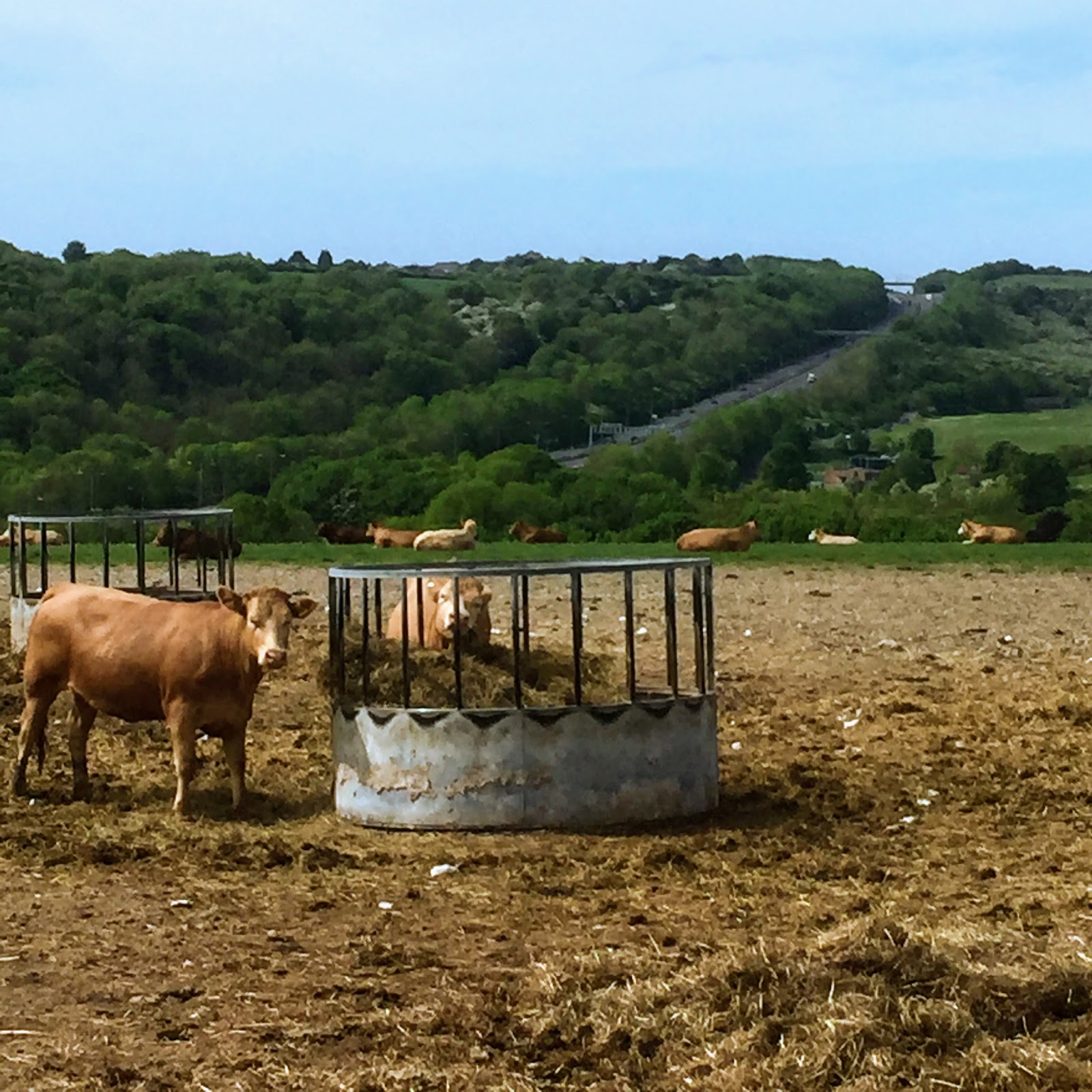
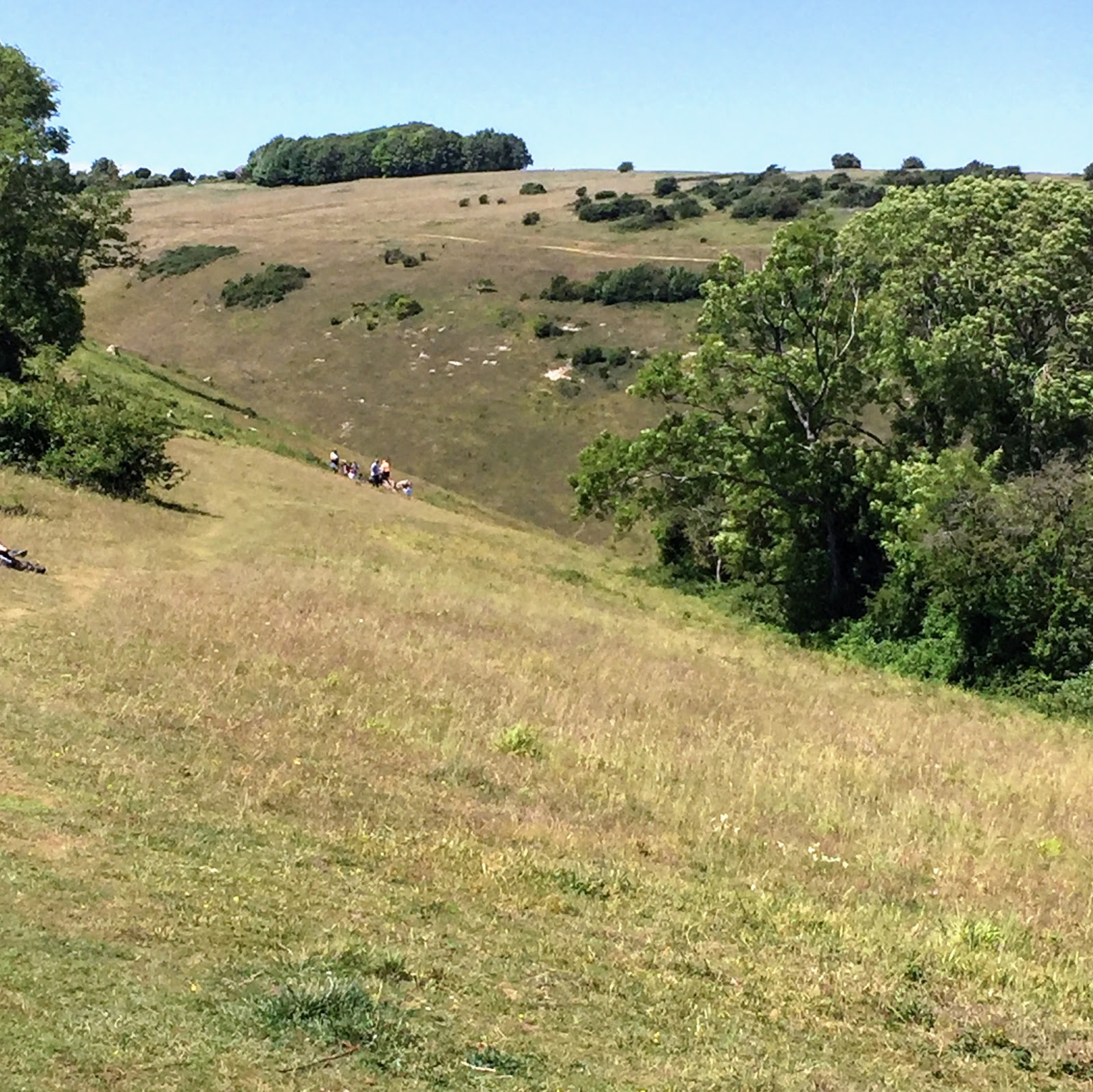
What a privilege it is to live in Sussex! Behind these cows you see the descent to Brighton from the Downs with the A27 speeding up on the right to Worthing. Once there were more cows and sheep than people in this part of the world but not anymore, even if Brighton & Hove’s expanding population is limited both by the South Downs and the sea. This picture was taken descending the Sussex Border Path as it ‘kisses’ Brighton above Patcham at the end of its leg from Rye before it heads west beyond Sussex to Emsworth in Hampshire.

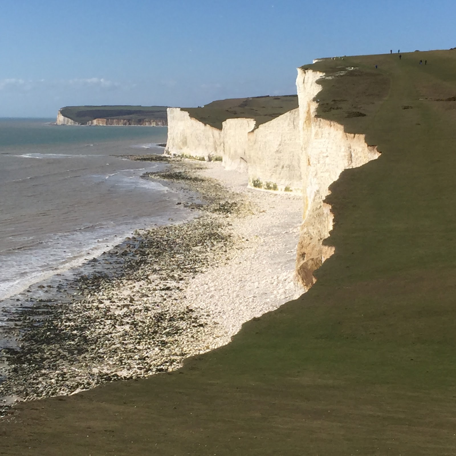
Three of the Seven Sisters. When you count the ‘ups and downs’ of the South Downs they look more like six and a half because of erosion. They lead from Cuckmere haven to Birling Gap where the cliffs descend to be accessible once to smugglers but today to visitors from Brighton & Eastbourne climbing the movable stairs from the beach. Housing in Birling Gap is also movable - prey to erosion! By contrast Belle Tout lighthouse (1832) visible on the horizon of this picture was on TV 17 March 1999 when engineers shifted it in its entirety 17 metres from the eroding cliff face.

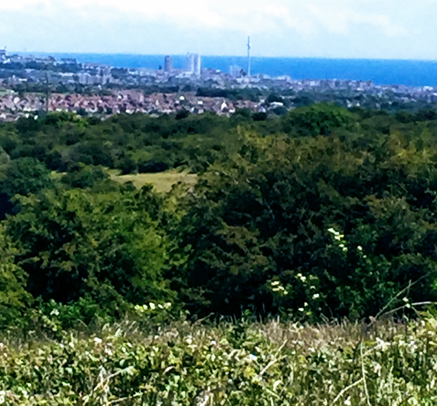
This fascinating sight is one of the rewards from escaping Brighton through Patcham to ascend the Sussex Border Path onto the South Downs. As you head towards Ditchling Beacon you see the radio station masts above Glynde to the far right and above Fulking to the far left. Further up Jack & Jill windmills appear to the left. Before all of these you see this oriental monument positioned above Brighton. The Chattri (1921) is a memorial to Hindu and Sikh Indian soldiers, previously hospitalised in Brighton’s Dome during World War One, who died and were cremated here on the Downs.

In this picture looking from the beach below Seven Sisters towards Seaford Head you sense the power of the sea. At low tide you can walk at ground level from Seaford to Birling Gap, paddling with care across the Cuckmere, to explore the caves and rock pools which are evidence of the erosion chalk limestone is prey to. The walk takes over an hour so it must be carefully checked against the tide times. It was worth the struggle, slipping around on the rocks, to take this picture which captures here some hidden beauty of Seven Sisters Country Park.
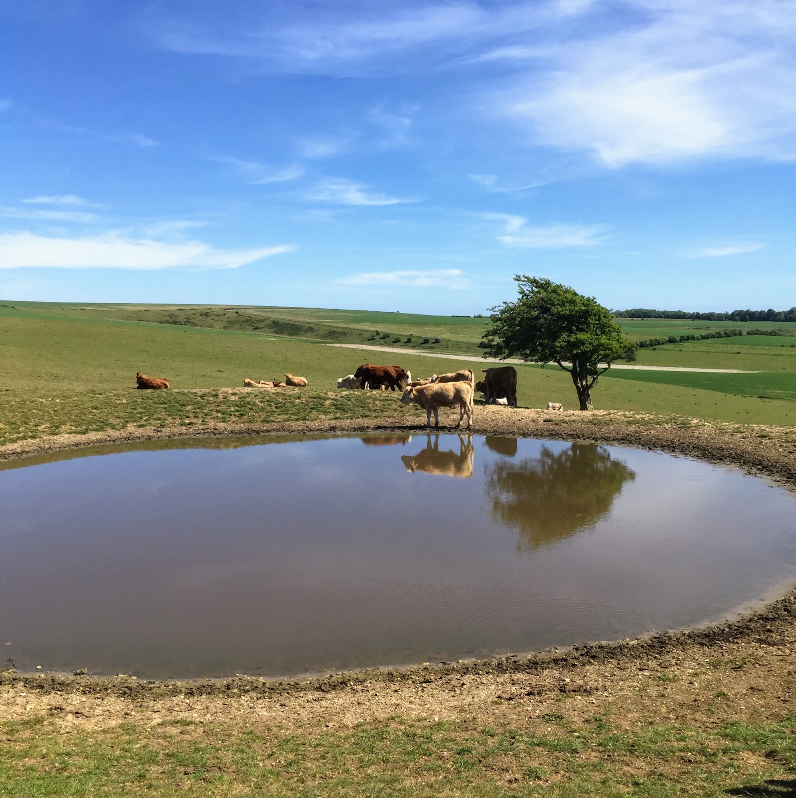
If you walk up from Brighton to Ditchling Beacon you encounter this dew pond that has watered sheep and cattle for centuries. The sea breeze guarantees heavy dew landing over the South Downs on the pond’s cold water. How does the water keep cold? The secret of Dew Ponds is their base which before plastic was layers of straw and clay producing the same effect as a thermos flask i.e. waterproof impermeability to heat transfer. As walkers know the chalk Downs are ideal wet weather walking as they are so well drained. The age-old technology behind Dew Ponds goes counter to this for the benefit of cattle and sheep drawn to graze where there is standing water.
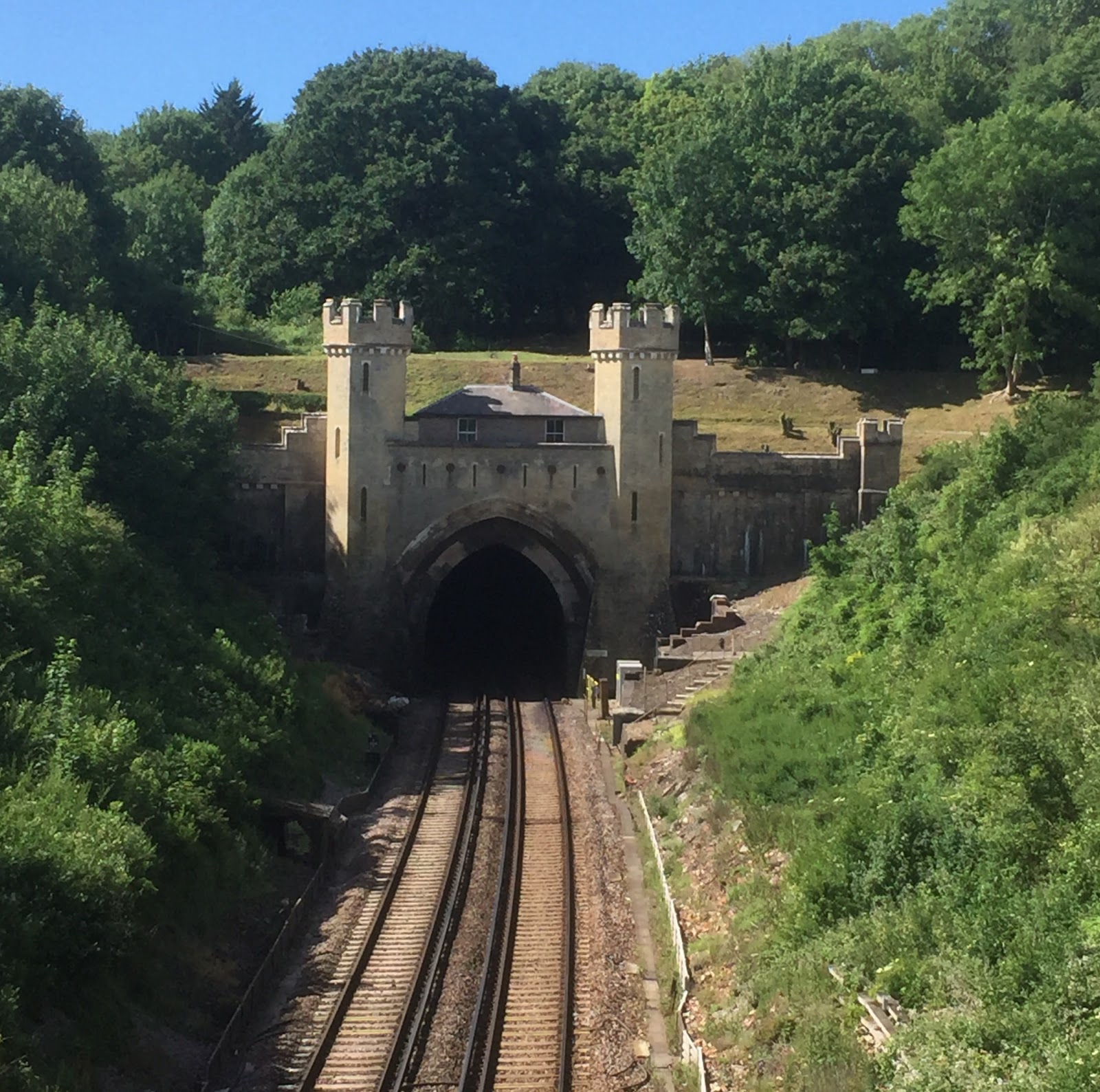
If you walk up from Brighton to Jack & Jill windmills and head down towards Pyecombe you see what millions of travellers on Brighton mainline never see - Clayton tunnel with its turreted and castellated north portal and the lamp-lighter’s cottage on top. The one mile 499 yard tunnel was first lit by gas which meant employing someone to relight lamps snuffed out by passing trains! Like the two grand pillars on the A23 this bridge provides a grand welcome for most of the 11 million who visit Brighton each year. You can return to Brighton from Clayton tunnel by catching the 270 or 272 bus from opposite Jack & Jill pub or following the footpath to Hassocks station.
Taking a bus up the Downs to Devil’s Dyke from Brighton and walking back is a favourite outing because I can enjoy the spectacular view of the city as I descend the footpath. Also, if I’m lucky, I’ll see the Isle of Wight. In one legend the Isle was a clump of rock thrown over his shoulder as the devil dug a way for the sea to flood Sussex in revenge for it becoming Christian. In fact the 300 foot valley or dyke was formed not 1,400 but 14,000 years back through river erosion at the end of the Ice Age. The Victorians came up Devil’s Dyke by railway and cable car and you can still see some bases.

If you take a bus from Brighton up to Devil’s Dyke you’re well equipped for a stroll east or west along the South Downs Way. The western path shown here is more straightforward and takes you to the Digital Audio Broadcasting (DAB) transmitters on Truleigh Hill of great benefit to Brighton & Hove and Sussex. There are lovely views to the right down at Poynings and Fulking. Unless you want to keep on the South Downs Way to Steyning, Amberley or even Winchester it's neat to drop down the footpath to the left at the radio masts which takes you more or less straight to Fishersgate station.

Cycling into Brighton on the invaluable track west of the A23 I took these pictures of the two pillars or ‘Pylons’ dating back to 1928. One has written on it this fine welcome to Brighton: ‘Hail guest, we ask not what thou art. If friend we greet thee hand and heart. If stranger no longer be. If foe our love shall conquer thee.' When the A23 was widened there was an inconclusive debate about producing a third Pylon to remove the vexed asymmetry we now experience passing by them. In 2006 on ‘My Brighton & Hove’ former Land Surveyor Edwin Macadam suggested the Council retain a square of land in case funds appear from somewhere to reproduce an identical third Pylon. This would create a more balanced welcome to the city for the millions who flood past the Pylons every year.
What I love about Brighton is less its vital urban sprawl than its situation between the South Downs and the sea captured in this picture descending to Fishersgate from the radio transmitters at Truleigh Hill along a remarkable, age-old straight path. You realise why the city is being forced to grow upwards being caught between the protected Downs and the sea. It’s particularly inspiring to walk under the sky among the greenery looking down at the city poised above the blue of the sea. Engaging with the natural, spacious surrounds of our busy city invites a wider perspective and settles the spirit.

An hour and a half’s walk up from Patcham past the Chattri memorial takes you to the top of the South Downs seen here in splendour framed by a hedgerow of Ditchling Common on the other side. Out of sight to the left of the picture is Ditchling Beacon which usually has an ice cream van to refresh walkers and to the right Jack & Jill windmills with their spacious car park. You can come or go from Brighton & Hove on the 270 or 272 buses which stop heading north at the Riding School on the South Downs Way or south at the junction of the track to Jack & Jill with the A273.
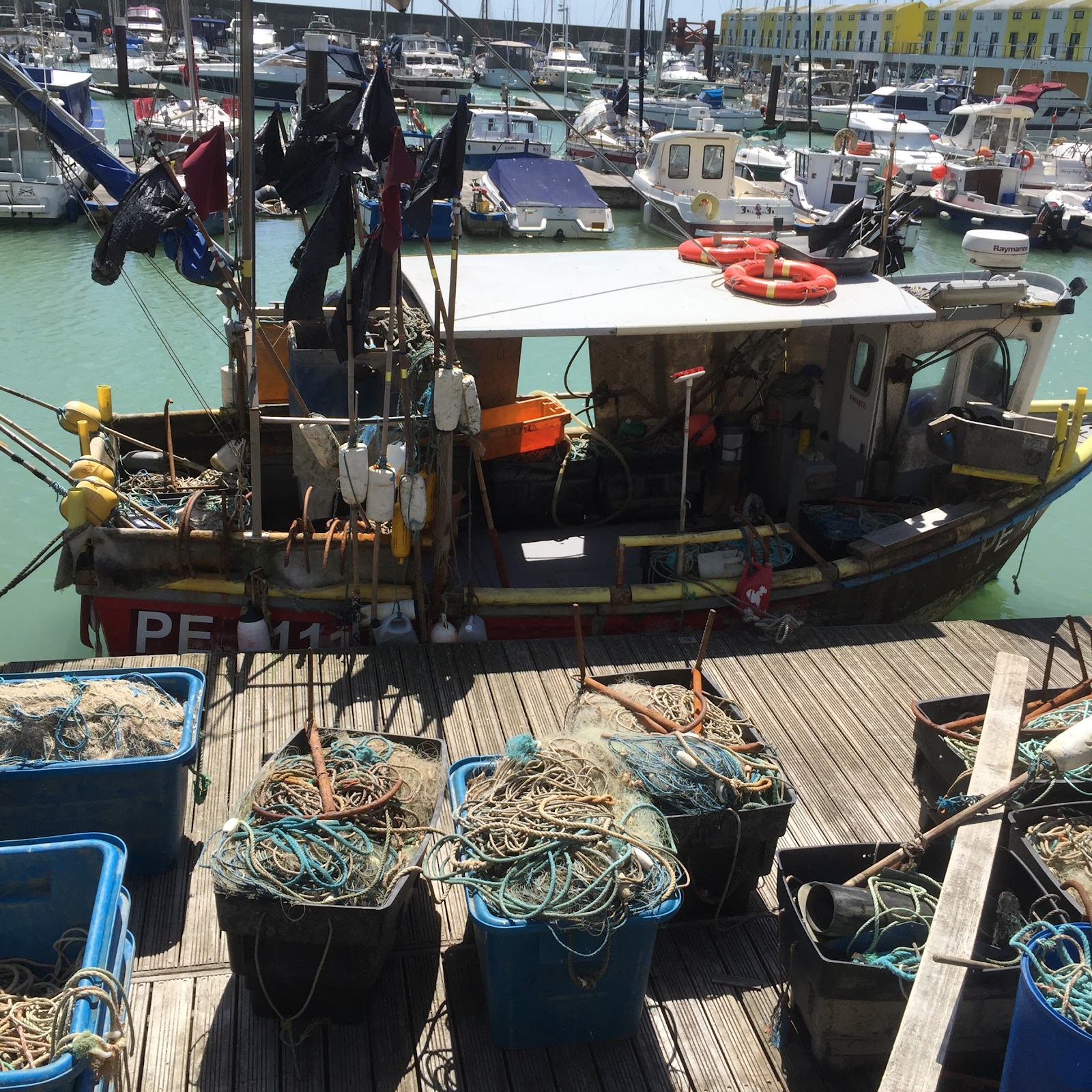
Love the rich variety of Brighton exemplified in this picture from the Marina where a fishing boat nestles among recreational vessels. This vessel helps me imagine Brighton’s first fishermen descending to what is now the Marina from Whitehawk Camp above, a Neolithic encampment (3500-2700 BC). Four thousand years on the Domesday survey (1086) chronicled Brighton as a fishing and agricultural settlement with a rent of 4,000 herring and a population a tenth of that at 400. Brighton moved on from catching herrings to catching bathers from the 1730s when a fad for bathing in seawater as a cure for illness caught on.

Advertising ‘stunning sea views, direct sea access and a private health club’ Bayside Apartments, Worthing is itself on that sea view from parts of Brighton & Hove let alone the South Downs. Construction is now more or less complete supported by a majority of townsfolk - it brings more people to Worthing - and to the grief of the minority who lament the shock to the eyes. As you drive in from Lancing you see the tower looming over you more and more until you pass the building sadly overshadowing Beach House (1820), one of the last surviving beach-side villas of the Regency Period frequented later by King Edward VII.

Getting up on the South Downs brings you into the company of those who would go up even further, the Paragliders. They don’t run and jump but let the wind carry them into suspension above the hills as in this picture taken above Glynde. Whereas hang gliders look like stealth bombers with their V-shaped aluminium frames, paragliders have a soft elliptical shape once their fabric is inflated. Watching them getting prepared to fly off is an added fascination when you walk the Downs on a breezy day, especially between Southease and Alfriston where there are three car parks on the Downs much used by the paragliding community.

Stumbled on this machine on top of South Downs whilst heading from Southease to Seaford. It beats my own lawn mower which is a grass strimmer since I’ve such a small patch of lawn! Amazing how much artificial harvesting of grass goes on in Sussex. By contrast the Downs were smoothed for thousands of years by grazing sheep! I think this machine - it looked so very new - is an investment to harvest cereal crops i.e. a combine harvester. Strange to find evidence of such intense human activity in the quiet and beautiful natural setting of the South Downs.


We’d have less of Seaford Head without these concrete cubes installed at its base. Cheaply produced they absorb the tireless energy of the sea whipped against the cliffs day by day by our prevailing southwesterly winds. The block heap doesn’t subtract from the beauty of the Head as you have to look round the corner at the end of Seaford promenade to see them. On the other hand without erosion we’d be the poorer - there’d be no Seven Sisters down the coastal path! Even now they’re looking to be renamed Six Sisters in a few score years as the sea claims more of the cliffs, as, very brutally, it has done at the other end of the Sisters cliff formation at Birling Gap.


Anne and I visited this shrine on Newhaven’s West Quay to two sailors presumed to have drowned when ‘Joanna C’ sank 21 November 2020. A third sailor was rescued. The men were from Brixham in Devon and their boat had previously sustained damage in a fracas with French fishing boats contesting access to scallops. Let’s hope the settlement with the European Union over fishing rights prevents such conflict in future and helps the welfare of people risking their lives day by day to bring fish to our dining tables.
Comments
Post a Comment